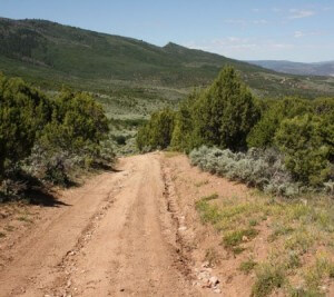
Abrams Ridge-McHatten-Pole Road-Horton Hike
Difficulty: Difficult
Accessibility: Hike, Bike, Horse
Trail Length: 9.68 miles
Elevation Gain: 2207 ft.
Elevation Loss: 2389 ft.
Trail time: 3:15
Highlights: A very long hike, McHatten Reservoir
Difficult start on Abrams Ridge. Flat and downhill for the middle of the hike with good single track on Fast Times to Pole Road. Hike back to start can be all road or a slightly more mild but longer single track. Small hill to finish on School House Rock.


